
Blogs

CAROLINE, THE THERMODYNAMIC MIRACLE

"In each human coupling, a thousand million sperm vie for a single egg. Multiply those odds by countless generations, against the odds of your ancestors being alive, meeting, siring this precise son; that exact daughter...until your mother loves a man ...and of that union, of the thousand million children competing for fertilization, it was you, only you...(it's) like turning air to gold... a thermodynamic miracle."

Those words, from Alan Moore’s “Watchmen,” indicate that despite the common features of all members of our species, the biological laws and relationships that apply to us all, each of us is unique in some way. I am reminded on this on the occasion of the birth of my first grandchild, Caroline Harper Phillips, yesterday.


Caroline Harper Phillips, age <1 day


But how is this relevant to geosciences? The obvious analogy is that while Earth surface systems (mountains, watersheds, forests, sinkholes, or whatever) have certain commonalities and are in part governed by principles that apply everywhere and always, each is also affected by the particular combination of environmental factors of a given location, and by a unique sequence of events. Like the contingencies affecting whether two people meet and reproduce, going back generation after generation, landscapes and Earth surface systems are affected by uncountable contingencies—events that did or did not happen; the occurrence and timing of meteor impacts, fires, floods, storms, earthquakes, bison herds, insect swarms, lightning strikes, droughts, landslides, gully erosion, dust deposition, human impacts, etc., etc., etc., over thousands to billions of years.

Knowing people is not just about knowing human biology, physiology, medicine, anthropology, psychology, sociology, and so on. It is about knowing individuals. The same goes for Earth surface systems. Place matters, and history matters, and truly understanding one of them, like understanding a person, requires dealing with them one-on-one. That’s the kind of approach to geosciences—integrating laws, place, and history—I’ve been advocating for a number of years. Right now, though, I plan to focus on getting to know Caroline, the thermodynamic miracle. 

INFINITE SAND GATORS


This unusual bedform was created by the self-organizing dynamics of ocean waves, wind, sand, and shells a couple of days ago.

OK, it wasn’t. It is the work of a vacationer at Myrtle Beach. But it got me to thinking, not only about what an awesome sand sculpture it is, but about uniqueness and probabilities in Earth surface systems.

In theoretical physics, the “many worlds in one” (MWO) concept holds that, with unlimited space and time, any outcome not forbidden by the first and second laws of thermodynamics (laws of conservation of mass and energy) will eventually occur (Vilenkin, 2007 is the standard source for MWO; I encountered it via Koonin, 2012). Thus, on some beach, somewhere, some time, waves and wind have independently sculpted a sand alligator.

However, while Earth science encompasses a lot of space and time, both are quite finite. Thus, while MWO predicts formation of a sand alligator sometime, somewhere in an infinite universe with probability = 1.0, the odds for such an occurrence (without human intervention) on this particular speck of space-time (Earth) are so low as to be essentially zero.

Earth surface systems—a sand beach, a pine forest, a karst sinkhole, or whatever--generally include regular, predictable aspects in common with other beaches, forests, and sinkholes around the world, and unique, idiosyncratic characteristics associated with their specific combination of environmental factors and history. Because of this, and the dynamical instabilities and chaos that sometimes lurk within the general or universal governing laws, many, many outcomes are possible. But not everything is possible.

I agree with the MWO to the extent that the only outcomes that are absolutely, completely impossible are those forbidden by the conservation laws. However, other general laws and principles relevant to Earth make some outcomes more or less probable, and some essentially impossible. For instance, I can concede, for the sake of argument, that somewhere in an infinite universe weathered rock becomes whole again, but on our planet it ain’t happening.

Also, the specifics of geography and history at a given time and place further rule out a number of outcomes (or, from the perspective of historical reconstruction, explanations of how something came to be).  Much of my research has emphasized the idiosyncracies, individuality, and instabilities of Earth surface systems, based on the unavoidable effects of specifics of geography and history. I typically think from this perspective as geography and history providing opportunities and degrees of freedom for the variety and individuality of Earth systems. However, it is also important to recognize that geographical and historical details (at scales from molecular to planetary) also provide constraints that limit what can happen.

------------------

Koonin, E.V., 2012. The Logic of Chance. The Nature and Order of Biological Evolution. Pearson.

Vilenkin, A. 2007. Many Worlds in One: The Search for Other Universes. Boston: Hill and Wang.

FLUVIAL BEACHES


A sandy beach is actually sometimes a pretty good place to think about fluvial forms and processes. The small streams, swashes, outfalls, and ebb-tide channels can be examined up-close, and they change several times each day, with the tidal cycle (here where I am at the moment in South Carolina, two high and two low tides each day). Thus Buck Swamp Creek, which discharges on the beach near where I’m staying, goes through four cycles of change a day.

A lot of work in recent years suggests that unless the material is pretty cohesive (which of course beach sand is not), without vegetation stream channels tend to be braided, and single-channel meandering forms are rare. You can see that here, where the marsh creeks—with plants and mud—are meandering, but develop nice braided patterns where they cross the sand. But along a mud coast near Cairns, Australia, where I spent some time last (N. hemisphere) summer, the same kinds of channels across the tide flats were meandering.

Braided channel crossing the beach at low tide, Myrtle Beach, SC. 

The changes observable over very short time periods are also quite instructive. These beach-streams are never the same at the same point in the tidal cycle two days in a row. Even where the weather is the same (as it unmercifully often is in coastal S.C. in August) and the waves coming in are the same, the channels change every cycle. This, to me, shows on a greatly accelerated time scale the importance of path dependence and contingency in fluvial systems. Minor changes in the shifting sands produce different outcomes. Traditional Earth science theory suggests that the same processes acting under the same boundary conditions produce the same results. That’s not how it works on the beach-streams of Horry County, South Carolina, or the planet in general.

That makes scientific prediction more difficult, but it also makes geomorphology more fun!

MYRTLE BEACH DAYS


A blessing (in my view) or a curse of being a geomorphologist is that you are never completely “off the clock,” because there are landforms and landscapes everywhere, and in all but the most heavily urbanized and industrialized areas, you can almost always see something interesting.

So here I am on vacation in Myrtle Beach, SC, a destination and timing selected because my son and daughter-in-law live here, and my grand-daughter is due within the next 10 days or so. I went out for a run on the beach this morning (one of the few surfaces my bad knees tolerate any more), and could not help but think that it would be a great day for a class field trip. Not a classic summer beach day by any stretch—cloudy, rainy, lightning out over the ocean, and a strong wind from the east, not typical at this time of year. But a lot to see along the shore.

Among other things, I could’ve shown students some nice plunging breakers, and a beach face slope more characteristic of winter than summer wind and wave conditions. At low tide, the ridges and channels in the sand showed very clear evidence of cellular circulation, associated with local alongshore variations in wave energy that create strong alongshore currents and out-to-sea rip currents (indeed, the county lifeguards had already put out the red no-swimming flags).

It’s been raining here a long time now, and every path through the dunes had a small stream running through it, across the beach and into the ocean. A good chance to talk about runoff dynamics in sandy soils, where infiltration is high, but in this low country when the water table gets high, the infiltration rate doesn’t matter because there’s nowhere for the water to go. The flow was a very pale yellow, almost whitish color, in strong contrast to the ocean water and tidal pools. This, I could’ve pointed out, is due to the fact that where there is any clay in the soil, it is mostly kaolinitic clay minerals—they disperse easily in water, and give it that light color.

Anyway, I’m hoping the weather clears soon, because it will make my wife and others here happier, and won’t bother me any. But for a geomorphologist, it is not a bad beach day. 

TOPOPHILIA, TOBACCO, & TACTICAL WEAPONS


Topophilia is the affective bond between people and places, and also the title of an influential 1990 book by human geographer Yi Fu Tuan. I was thinking about this yesterday as my wife and I drove across the North Carolina coastal plain to visit relatives. Highway 70 from Raleigh east toward the coast is not a scenic drive by any objective standard. The topography is flat and monotonous, and the road corridor is infested with strip malls, billboards, convenience stores, and tourist traps.

Yet, as it does every year when I make the trek east from Kentucky, this crappy stretch of highway triggered fond associations with eastern North Carolina—topophilia, I reckon. I am a native of the region, taught for nine years at East Carolina University, and my wife’s family lives there. My post-dissertation field research sites were there, and there are some sites I still monitor during my family visits.


There is nothing much of interest to view from US 70, but when I cross a creek, it reminds me of the many days I’ve spent—both in research and recreation—on the rivers and streams and swamps and marshes of the N.C. Coastal Plain. The tobacco fields had mostly just undergone their first priming (harvesting) of the lowest leaves or “sand lugs” that mature first (for my Kentucky friends from burley tobacco country, the flue-cured tobacco of eastern NC is harvest one leaf or layer of leaves at a time, rather than cutting the whole stalk). That reminded me of what it was like in the small farming towns I grew up in when the warehouses opened in late summer, and people who’d been scraping by had money in their pockets for a change. You could smell the tobacco curing in the barns, feel the excitement on the small town streets, and you listened to the farm reports to see what the prices were. I’m not a big fan of tobacco products and the corporations that sell them, but for better or worse, it’s part of my topophilia.

Later, when I began doing soil geomorphology and pedology research in the coastal plain, I learned to quickly recognize the common soil types—the ubiquitous Norfolk, Goldsboro, Lynchburg and Rains loamy sands, the thick sands of the Wagram and Troup, the clayey Craven and Lenoir, and the peats and mucks of the swamps and pocosins. The tobacco and corn and soybean fields don’t look like much, but they remind me of the underlying soils, and the rewarding days with the soil probe, auger, and shovel.

North Carolina in general, and eastern N.C. in particular, has always been way too right wing and reactionary to suit me (“conservative” doesn’t do their/our politics justice). Amazingly, in the 17 years I’ve been gone (and remember, I spent those years in Kentucky and Texas, so it’s not like I haven’t been in contact with the Fox news-watchers), it has gotten even more regressive, repressive, and aggressive. Along highway 70, for example, there are even more gun stores than there used to be, and yesterday’s drive featured several signs advertising sales on assault rifles. Lord have mercy . . . .

The hate-and-fear politics of those people disturbs me. But those people are my people. The rape and pillage of the coastal waters and landscapes by the developers and their political cronies disgusts me. But the unsullied bits that are left still call to me. Running on some trails in Croatan National Forest this morning, I realized that I have almost a paternal feeling about that landscape.

Colt AR-15 assault rifle--on sale now along US highway 70 in North Carolina!


Human geography, environmental perception and psychology, etc. are well beyond my professional capabilities, and I don’t pretend to understand topophilia beyond my own experiences with it. But just as we may love some people despite some serious flaws, places don’t necessarily have to earn or deserve our affection. On the other hand, topophilia is not, for me, a simple matter of familiarity. Every time I head east on 70, I feel better when I put Raleigh in the rear view mirror. I also spent time in that part of N.C., and even though nothing bad happened to me there, I have absolutely no place affection for the Raleigh-Durham area.


AMPLIFIERS & FILTERS


A big problem with predicting responses to global climate change (or other environmental changes) is that they are nonlinear and thus disproportionate. Sometimes large changes can have relatively small responses, while in other cases small changes can have disproportionately large impacts.

Responses to environmental change are sometimes characterized by amplifiers—phenomena that reinforce or exaggerate the effects of the change. For example, if coastal land is subsiding, this amplifies the effects of sea level rise. Or, when warming results in permafrost thawing, this releases methane, a heat-trapping greenhouse gas, this leads to further warming. However, there are also filters—phenomena that resist, offset, or diminish the effects of the change. For instance, if coastal land is tectonically or isostatically uplifting, this can offset or even eliminate effects of sea level rise with respect to coastal submergence. Or, if warming results in increased cloud cover, which reflects more radiation, this counteracts the warming.

Marshes in the Trinity River delta, Texas, part of the Galveston Bay complex (Google Earth image). Here subsidence due to a combination of natural compaction and human activity (extraction of oil, gas, and water) is resulting in subsidence of the wetlands, which amplifies effects of rising sea level. 


I was reminded of this by today’s news (http://www.sciencedaily.com/releases/2014/07/140728153933.htm) of confirmation of an amplifier effect of global warming—water vapor increase in the upper troposphere. Because H2O is a greenhouse gas, and cloud formation is not an issue in the upper troposphere, this is a clear amplifier effect. The summary of the news story: “A new study . . . confirms rising levels of water vapor in the upper troposphere -- a key amplifier of global warming -- will intensify climate change impacts over the next decades. The new study is the first to show that increased water vapor concentrations in the atmosphere are a direct result of human activities.”

The responses to the (proven and undebatable) increase in the global concentration of carbon dioxide and other greenhouse gases include both amplifier and filter effects, as we talk about quite a bit in my GEO 130 (Earth’s Physical Environment) class. If it were not for some of the filter effects (i.e., if the physics of greenhouse gases were the only thing affecting temperature), it would already be hotter than it is (and it is getting hotter, globally). On the other hand, right now the weight of the evidence suggests that the amplifier effects, such as the tropospheric water vapor, and the fact that land and ocean surfaces bared by melting ice absorb more radiation than ice, are winning.

The amplifier and filter concept also applies to geomorphological, ecological, and other (including economic and political) responses to climate change. The climate changes themselves can be amplified or filtered, and the responses of, for instance, landforms or vegetation to the net climate change can themselves be amplified or filtered. Thus you could have several layers of amplification ratcheting up the effects of change, several layers of filtering diminishing or obscuring those effects, or some combination of amplifiers and filters.

I examined this in the context of how Kentucky rivers have responded to climate change in the last couple of million years (Phillips, 2010). Another piece discusses amplifiers and filters in more detail with respect to how landforms and landscapes respond to all kinds of disturbances (Phillips, 2009).

Phillips, J.D. 2010.  Amplifiers, filters, and the response of Kentucky rivers to climate change. Climatic Change 103: 571-595.

Phillips, J.D.  2009.  Changes, perturbations, and responses in geomorphic systems.  Progress in Physical Geography 33: 17-30.


OCBILs & YODFELs


I recently stumbled upon the OCBIL theory. In the words of Hopper (2009): “OCBIL theory aims to develop an integrated series of hypotheses explaining the evolution and ecology of, and best conservation practices for, biota on very old, climatically buffered, infertile landscapes (OCBILs). Conventional theory for ecology and evolu- tionary and conservation biology has developed primarily from data on species and communities from young, often disturbed, fertile landscapes (YODFELs), mainly in the Northern Hemisphere.” As a geomorphologist, and in particular a biogeomorphologist interested in coevolution of landscapes, biota, and soils, the OCBIL-YODFEL contrast is extremely interesting—mainly because it implies a key role for landscape age, stability, and geomorphic disturbance regimes in the development of ecosystems and evolution of biodiversity patterns.

The basic line of reasoning is that the geomorphic setting of OCBILs results, through natural selection, in biotic assemblages that differ fundamentally in their traits from biotas evolving in YODFELs. This has implications for biodiversity and conservation strategies (Hopper’s primary concern). The antiquity and relative lack of disturbance (particularly by glaciations) of Gondwanan remnants of the southern hemisphere has long been noted by geomorphologists such as Rowl Twidale, T.R. Paton, Geoff Humphries, Cliff Ollier, and Colin Pain to result in many landform, soil, and regolith characteristics that differ markedly from what is typically found in Eurasian and North American settings. The latter have been much more frequently disturbed, directly or indirectly, by glacial/interglacial cycles during the Quaternary. In particular, the geologically old, relatively flat, dry, unglaciated landscapes of Australia and southern Africa have produced geomorphology, in the sense of scientific practice as well as the landscape itself, quite different from the dominant European and North American views. The geomorphologists mentioned above are or were all based in Australia for most of their careers, and Hopper, not surprisingly, is also an Aussie (a biologist, he was a student of Twidale’s).

It is not surprising that areas with large differences in landforms, climate, and soils would produce different ecosystems and evolutionary trajectories. However, as the burgeoning literature of biogeomorphology and niche construction shows, this is not only a matter of organisms adapting to environmental constraints. This is a two-way street, with biota also influencing landforms and soils. Further, factors such as longer time periods between major disturbances such as glaciations and volcanic eruptions, and persistence of more-or-less consistent climates, greatly increases the number of possible evolutionary trajectories.

Thus far, OCBIL theory has taken some long-recognized ideas from geomorphology and pedology and applied them to evolutionary and conservation biology and ecology. Many of the evolutionary adaptations of OCBIL plants identified involve biogeomorphic engineering, such as sand-binding roots and clay mineral synthesis. Thus there is a great opportunity for new insights into coevolution of biota, landforms, and soils.

------------

Hopper, S.D., 2009. OCBIL theory: towards an integrated understanding of the evolution, ecology and conservation of biodiversity on old, climatically buffered, infertile landscapes. Plant & Soil 322: 49-86. 

PHYTOTARIA, SOILS, & LANDFORMS


One of my major research interests is the coevolution of soils, landforms, and biota. I’ve been working in this area pretty steadily since about 2000, but until 2013 I was completely unaware of some work being done along the same lines, over about the same time period. This is the work of W.H. Verboom and J.S. Pate from Western Australia, who among other things developed the “phytotarium concept.” Phytotarium defines the specific plants and microbial associates driving specific pedological changes during niche construction. This concept, and a wealth of work on biogenic origins of pedological and geomorphological features such as clay pavements, texture-contrast (duplex, as they call them in Australia) soils, and laterites, was highly relevant to my own thinking (e.g., Phillips, 2009a; 2009b), but though I consider myself familiar with the biogeomorphology and pedogenesis literature, then and now, I had somehow missed it.

Deep sandy duplex (vertical texture contrast) soils, Western Australia. Photo credit: Dept. of Agriculture & Food, Western Australia.

I finally became aware of their work when they synthesized it in an article in Geoderma (Verboom & Pate, 2013), a key soil science journal that I follow (I am actually on the editorial board). I immediately contacted Verboom, apologized for not citing their work, and asked for reprints of the earlier stuff, which he sent at once. As it turns out, they were also until then unaware of my publications.

The reason—publication venues. Pate and Verboom published their earlier work (see references below) on phytotaria and bioengineering of soils in journals I do not normally read, such as Plant & Soil and Annals of Botany. These are solid, well-respected journals, and at least as valid a place to publish this sort of work as Geoderma and American Journal of Science (which despite the name is an Earth sciences journal), where my articles were printed. While I follow some of the ecology and biogeography journals as well as the geosciences literature, I cannot keep up with them all, and certainly not botanical publications, too.

So what’s the message or lesson here, other than that you should check out Verboom and Pate’s work, which is outstanding? I’m not sure. I could reiterate some standard homilies about the need to read and think broadly and outside one’s subdiscipline, which are true enough. However, being a pedologist, geomorphologist, or soil biologist already entails roaming a pretty broad transdisciplinary territory. I doubt soil biologists or botanists have any time to read geomorphology journals, any more than I have time to follow their venues. Search tools and databases help a lot, but in some cases, such as this one, we did not happen to use keywords that turned up each others’ work. But I also don’t feel I should leave this as “just one of those things.” So, homilies aside, I suppose we should all remain aware that there may be, and probably are, relevant ideas being floated outside our specialties. No matter how diligent we are, given our finite time and the ever-expanding scientific corpus, our normal search patterns are not going to detect it all. Thus we should be thankful rather than annoyed when reviewers point out things we missed, and for serendipitous discoveries, such as when I happened on Verboom and Pate (2013). Second, we should perhaps pay more attention to the keywords we submit with our papers to increase the likelihood that our work falls into the hands of those outside our specialty groups.

References

Pate JS, Verboom WH. 2009. Contemporary biogenic formation of clay pavements by eucalypts: further support of the phytotarium concept. Annals of Botany 103: 673-685.

Pate JS, Verboom WH, Galloway PG. 2001. Co-occurrence of Proteaceae, laterite, and related oligotrophic soils: coincidental associations or causative inter-relationships? Australian Journal of Botany 49: 529-560.

Phillips JD. 2009a. Biological energy in landscape evolution.  American Journal of Science  309: 271-290.

Phillips JD. 2009. Soils as extended composite phenotypes.  Geoderma 149: 143-151.

Verboom WH, Pate JS. 2003. Relationships between cluster root-bearing taxa and laterite across landscapes in southwest Western Australia: an approach using airborne radiometric and digital elevation models. Plant and Soil 248: 321-333.

Verboom WH, Pate JS. 2006. Bioengineering of soil profiles in semiarid ecosystems: the ‘phytotarium’ concept. A review. Plant and Soil 289: 71-102.

Verboom WH, Pate JS. 2013. Exploring the biological dimensions to pedogenesis with emphasis on the ecosystems, soils, and landscapes of southwestern Australia. Geoderma 211-2: 154-183.

Verboom WH, Pate JS, Aspandiar M. 2009. Neoformation of clay in lateral root catchments of mallee eucalypts: a chemical perspective. Annals of Botany 105: 23-36.

Sycamores and Hillslopes

Below are some recent photographs of sycamore trees (Platanus occidentalis) in limestone bedrock at Herrington Lake, Kentucky (about37.78o N, 84.71o W). As you can see, the tree roots and trunks exploit joints in the rock, and accelerate weathering both by physically displacing limestone slabs and widening joints by root growth, and by facilitating biochemical weathering along both live and dead roots.

Sycamores rock

These are some nice examples of root/bedrock interaction, and the general phenomena are not uncommon, though usually much more difficult to see. The Herrington Lake shores also appear to illustrate a process by which the sycamores accelerate weathering and mass movements (other trees are also involved, but Platanus occidentalis seems to be the most common and effective):

1. Plants colonize the exposed bedrock, with roots exploiting bedrock joints.

2. Tree roots accelerate weathering and loosen joint blocks.

3. While the tree is still alive, root growth envelopes rock fragments and the trees provide a physical barrier to downslope transport.

4. When the tree dies, the rock fragments are released downslope.

Field evidence of all these steps is rather obvious and abundant. However, it remains to be demonstrated that the sycamores and related trees result in faster weathering and hillslope degradation than would otherwise occur.

Sycamores rock

Sycamores rock

Herrington Lake was formed by damming (in the 1920s) the Dix River gorge. As a deep, steep-sided, bedrock controlled gorge, the lakeside hillslopes are characterized by exposed bedrock and thin soils. The creation of the lake may have provided an unusual opportunity for Platanus occidentalis colonization. Sycamores are highly shade intolerant and require direct sunlight for establishment. The lake setting provides that. The tree also requires moist conditions (it is quite common on river banks and in bottomlands in the region). The presence of the lake ensures that along the lower slopes, roots penetrating joints will soon encounter water. Finally, sycamore is native to the region (though usually more scattered than is the case along Herrington Lake) along streams, and seeds are dispersed by water (as well as wind). Thus the Dix River and other lake tributaries provided a seed source.

Beyond being a good example of root-rock interactions that are important in weathering, pedogenesis, and forest geomorphology, the Herrington Lake sycamores raise two other interesting issues:

1. The role of vegetation in destabilizing rather than stabilizing hillslopes. This has been noted before in other contexts, but usually with respect to hydrological rather than rock weathering effects.

2. The role of relatively benign (compared to say, deforestation or alien invasive species) ecological change in producing profound geomorphic change.

Sycamores rock

Sycamores rockSycamores rock


Information about Platanus occidentalis was taken from: Sullivan, Janet. 1994. Platanus occidentalis. In: Fire Effects Information System, U.S. Department of Agriculture, Forest Service, Rocky Mountain Research Station, Fire Sciences Laboratory. Available: http://www.fs.fed.us/database/feis/ [2014, June 4].

My own published work on tree root effects includes:

Phillips, J.D., Marion, D.A., Turkington, A.V.  2008.  Pedologic and geomorphic impacts of a tornado blowdown event in a mixed pine-hardwood forest.  Catena  75: 278-287.

Phillips, J.D., Turkington, A.V., Marion, D.A. 2008.  Weathering and vegetation effects in early stages of soil formation.  Catena 72: 21-28.

Phillips, J.D.  2008.  Soil system modeling and generation of field hypotheses. Geoderma 145: 419-425.

This will soon be greatly expanded upon by Michael Shouse’s PhD dissertation (University of Kentucky), which will become available later this summer. 

Antarctic ice, sea-level, & rivers


The long-speculated collapse of the west Antarctic ice sheet is underway, and also appears to be on an unstoppable trajectory. According to the recently-published research documenting this (Joughin et al., 2014; McMillan et al., 2014; Rignot et al., 2014) it will likely take a couple of centuries for the ice sheets to transfer their water to the sea (in the case of land ice). Among other things, this means that already rising sea levels will accelerate (see this NASA summary discussion on past meltwater pulses and their effects on sea level: http://www.giss.nasa.gov/research/briefs/gornitz_09/)


One of the many problems associated with ongoing and accelerating future sea level rise—both practical and scientific—involves the response of rivers near the coast. Rapid sea level rise means a rapid rise in the base level for the rivers. How will they respond? The only things we can say for sure is that the sudden (from a geological viewpoint) rise in base level will trigger geomorphic, hydrologic, and ecological responses, and that these responses will be highly variable from river to river. There are certainly some general principles and laws—any fluvial geomorphology text will have them—governing how fluvial systems respond to base level change. But these responses are also strongly influenced by the environmental framework (regional topography, geologic setting, lithology, rock, soil, and sediment types, vegetation, climate, and so on) and by their own histories—affects of both past and contemporary sea level, climate, hydrological, and other changes.

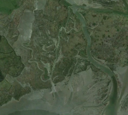
My own work on rivers of the Gulf of Mexico (GoM) coastal plain in the U.S.—all profoundly affected by sea-level change during the Quaternary, and by rising sea-levels in recent history—illustrates this variability. The Trinity, Neches, and Sabine Rivers are adjacent to each other in southeast Texas and southwest Louisiana. Their environmental frameworks and histories are about as similar as you are likely to see—in fact, they are really all part of a single larger river system, with their confluences now beneath Sabine Lake estuary (Neches and Sabine) or the GoM continental shelf. Yet, even these neighboring, similar river systems exhibit significant differences in how they have responded to Holocene and recent changes in climate and sea-level. This is reflected in, among other things, their avulsion (channel-shifting) regimes, patterns of channel-floodplain connectivity, and the morphology of the lower river valleys and deltas. These differences are linked to antecedent (inherited) morphological features within the river valleys, historical happenstance, and local disturbances such as tectonic movements or logjams (see the “Phillips” citations below, which also reference the work of others on these rivers and GoM coastal plain in general).

While this region provides useful lessons for investigating this topic, I can’t propose the GoM rivers as a general model—how could I, when they differ so much among themselves? The point is that no one scenario or predictive model will be applicable all affected rivers—even if you limit it to certain types or classes of river. We have to pay attention to the local details, so that we can understand what constrains their behavior, and what might amplify or dampen base level-driven changes.

Models of all kinds can be useful in identifying possibilities, along with studies of contemporary processes and recent historical responses. The paleoenvironmental record, which in many cases includes effects of past meltwater pulse-driven sea-level rise, can help a lot. Just because something has happened before does not mean that it will happen again, but we can take it as a law that if it did happen, it can happen.

Another approach is to look at analogs. One of these is dams and reservoirs, which raise the local base level from the channels upstream just as sea-level rise does. The analogs are not exact, or perfect, of course, due to the different rates or paces of base level change and different environmental factors, but can still expand our catalog of fluvial responses. Most studies of geomorphic impacts of dams have focused on downstream impacts. And most studies of reservoir sedimentation have focused entirely on the lakes, not upstream areas. So this is a topic ripe for more research.

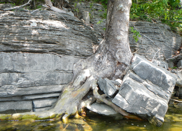
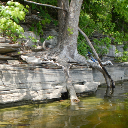
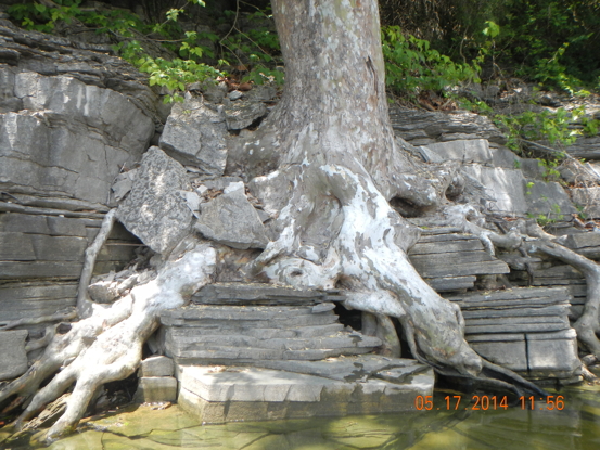
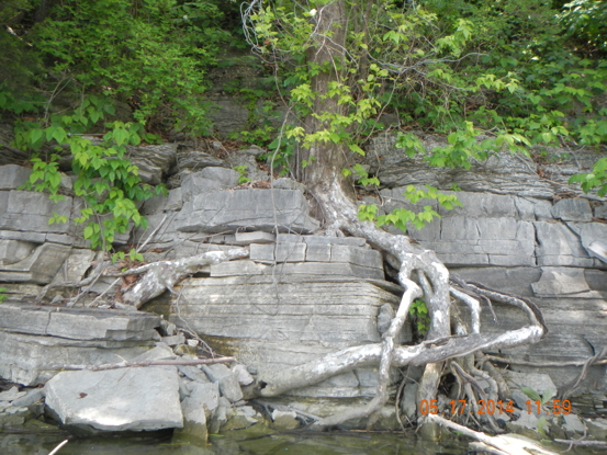
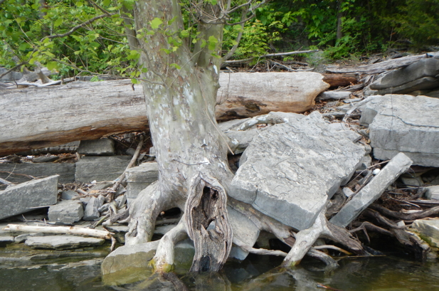
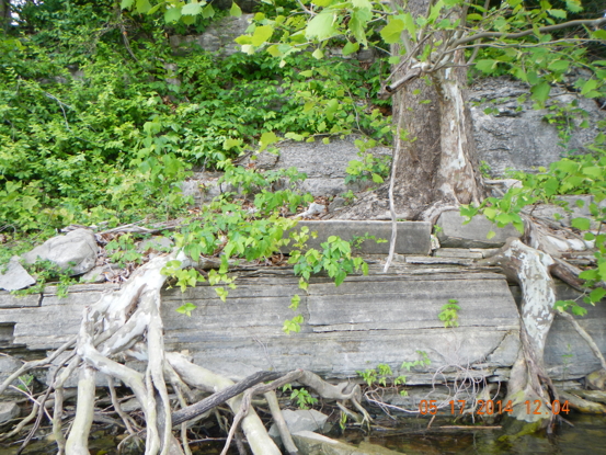
Lake-head deltas are common, and the channels upstream commonly take on the multi-channel, anastamosing forms common in aggrading systems. But certainly this is not always the case. In my “home” lake (Herrington, Kentucky), for example, the tributary streams are bedrock-controlled. Due to the dominant nature of erosion of these channels (weathering along joints and bedding planes in the limestone, followed by “plucking” at high flows), these are typically characterized by a series of bedrock steps, often featuring waterfalls or cascades. When Herrington Lake was filled (in 1927), the lower valleys of the tributary creeks were flooded. However, because of the steep slopes of the streams and the bedrock steps, the backwater effects of the lake only occur up to the next step upstream—in every case I’ve seen so far, no more than a few 10s of meters. Steep bedrock rivers, or those with pronounced knickpoints in the lower reaches, are thus likely to have more localized impacts than, say, low-gradient coastal plain rivers.

Stepped surfaces of various kinds, and some very subtle, are not uncommon in lower river reaches even without bedrock control, due to both alluvial and marine terraces. One can conceive of highly localized impacts downstream of a “step” or knickpoint, with little or no change upstream—until water levels breach the feature. Then a rapid inland or upstream expansion of effects can occur. The sedimentary record of several GoM systems, for instance, shows evidence of this sort of thing (e.g., Anderson and Rodriguez, 2008).

The recent reports from Antarctica make it clear that its time to redouble our efforts in the study of fluvial responses to rising base level, as changes are likely to be fast and furious in coming decades.

-------------------------

Anderson, J.B. and A.B Rodriguez, eds., Response of Upper Gulf Coast Estuaries to Holocene Climate Change and Sea-Level Rise (pp. 121-146).   Boulder, CO: Geological Society of America Special Paper 443.

Joughin, I., B. E. Smith, B. Medley. Marine Ice Sheet Collapse Potentially Underway for the Thwaites Glacier Basin, West Antarctica. Science, 2014; DOI: 10.1126/science.1249055

McMillan, M., A. Shepherd, A. Sundal, K. Briggs, A. Muir, A. Ridout, A. Hogg, D. Wingham. Increased ice losses from Antarctica detected by CryoSat-2. Geophysical Research Letters, 2014; DOI: 10.1002/2014GL060111

Phillips, J.D., 2014.  Anastamosing channels in the lower Neches River valley, Texas. Earth Surface Processes and Landforms. DOI: 10.1002/esp.3582.

Phillips, J.D., 2013. Watershed fragmentation in coastal plain rivers. Physical Geography 34: 273-292.

Phillips, J.D.  2011.  Universal and local controls of avulsions in southeast Texas rivers. Geomorphology 130: 17-28.

Phillips, J.D. 2009. Avulsion regimes in southeast Texas rivers.  Earth Surface Processes and Landforms 34: 75-87.

Phillips, J.D., Slattery, M.C.  2008.  Antecedent alluvial morphology and sea level controls on form-process transition zones in the lower Trinity River, Texas.  River Research and Applications 24: 293-309.

Rignot, E., J. Mouginot, M. Morlighem, H. Seroussi, B. Scheuchl. Widespread, rapid grounding line retreat of Pine Island, Thwaites, Smith and Kohler glaciers, West Antarctica from 1992 to 2011.. Geophysical Research Letters, 2014; DOI: 10.1002/2014GL060140