
By Whitney Hale, Erin Holaday Ziegler
 University of Kentucky students took a new look at some historical images of Lexington in a groundbreaking, campuswide collaboration.
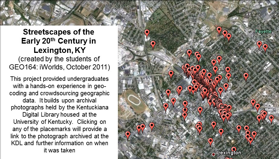
As part of his "GEO 164 iWorlds" class this past semester, geography professor Matthew Zook assigned students the task of geocoding photographs of streetscapes of Lexington from the first half of the 20th century. Students were tasked with using descriptive metadata, including the street address, to determine the likely location of the photograph.
"This project provided undergraduates with hands-on experience in geocoding and crowdsourcing geographic data," said Zook. "Furthermore, we've created a resource that will endure beyond the semester and be of interest to the larger community."
The project built upon archival photographs held by Special Collections at UK Libraries. The resources were made available through the Kentuckiana Digital Library (KDL), which is managed by UK Libraries.
The photographs for the project were primarily selected from The Asa C. Chinn Downtown Lexington, Kentucky Photographic Collection and the Collection on Lafayette Studios.
"Adding geocoding to these resources will allow researchers to see on a map where the photograph was taken," said Deirdre Scaggs, associate dean of Special Collections. "It will allow users to visualize what this particular area looked like during different decades. There are countless possibilities that this service will provide."
Each student's efforts were aggregated and cross-checked, and multiple students were assigned the same photo to increase accuracy, to create a student generated and collective effort for a new interface to the visual history of Lexington.
The resulting map, which is viewable within Google Earth, allows one to click on a placemark and see the photo and provides a link back to the KDL for further information.
"This collaboration demonstrates the important collaboration between undergraduate education and research and the unique materials held by Special Collections," Zook said.
“I hope that this is just the beginning of our collaboration," Scaggs said. "We have an estimated two million photographs in Special Collections, but we would like to expand this venture to include family letters and papers as well. In this case, our users would be able to see on a map where individuals were writing from and to. It adds another dimension to the study of these resources.”
UK's Special Collections houses nearly two million historic photographs of the Commonwealth and beyond and is home to UK Libraries' collection of rare books, Kentuckiana, the Archives, the Louie B. Nunn Center for Oral History, the King Library Press and the Wendell H. Ford Public Policy Research Center.
This project is part of the “New Mappings Collaboratory” at UK committed to innovations in mapping.
Drawing on both applied and conceptual traditions in mapping practices and mapping thought, New Maps represents a new initiative in interdisciplinary scholarship centered in the Department of Geography and UK's College of Arts and Sciences.
New Maps focuses on public engagement, "big data" and user-generated Internet content, as well as place-based thinking, analysis and representation. As a catalyst for mapping engagements on and off campus, New Maps works to promote creativity, excellence and interaction around emergent mapping technologies.