Understanding Spatial Media

Editor(s):
Matthew W. Wilson
Rob Kitchin
Tracey Lauriault
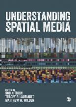
Book summary:

Over the past decade, a new set of interactive, open, participatory and networked spatial media have become widespread.  These include mapping platforms, virtual globes, user-generated spatial databases, geodesign and architectural and planning tools, urban dashboards and citizen reporting geo-systems, augmented reality media, and locative media.  Collectively these produce and mediate spatial big data and are re-shaping spatial knowledge, spatial behaviour, and spatial politics.


Publication year:
2017
Publisher:
SAGE
Bio:
Photo:
Short bio:
Matthew W. Wilson, PhD, is Associate Professor of Geography at the University of Kentucky and Visiting Scholar at the Center for Geographic Analysis at Harvard University. He co-founded and co-directs the New Mappings Collaboratory which studies and facilitates new engagements with geographic representation. He is co-editor of Understanding Spatial Media (SAGE), and his most recent book is New Lines: Critical GIS and the Trouble of the Map (University of Minnesota Press). He has previously taught at Ball State University and the Harvard Graduate School of Design, and his current research examines mid-20th century, digital mapping practices. He earned his PhD and MA from the University of Washington and his BS from Northwest Missouri State University. His childhood was spent in Pumpkin Center, Missouri, a small farming community in Nodaway County, where his family has farmed for over 150 years.
A&S department affiliation: