
By Guy Spriggs, Sarah Geegan
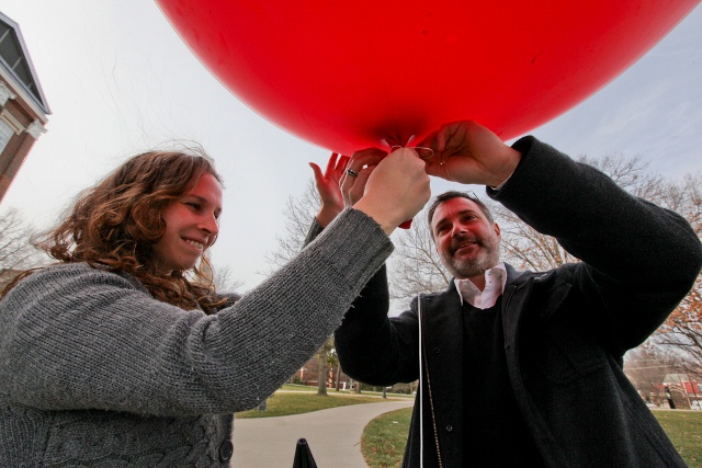 The cutting edge experiment didn’t require any million-dollar equipment — just a camera, a 2-liter soda bottle, a balloon, rubber bands and string.
Associate Professor Jeremy Crampton of the Department of Geography met his Intro to GIS (Geographic Information Systems) students in front of the Main Building on a windy February day. Their project? Survey the western border of UK’s campus using the balloon and a process called citizen remote sensing.
By simply suspending a camera from the balloon, this technique allowed students to not only physically map an area, but to use other forms of recording, such as thermal imaging, to capture data on vegetable health and building efficiency.
“We can stitch these images together to form a composite image,” Crampton said. “Anyone should be able to do this.”
Using this equipment, it is possible to gather images and create a map of UK’s campus for less than $300. This makes citizen remote sensing a great option since, according to Crampton, utilizing copyrighted photographs can cost $700 per image.
The photos created with citizen remote sensing are not only less expensive and higher resolution than images from resources like Google Maps, they can also provide useful metadata on the times and dates when the photos were taken.
“This technique was used to document the 2010 oil spill in the Gulf of Mexico. Any group that wants to monitor any sort of activity can use this,” Crampton said.
While GIS can be viewed by students as a job-training step toward a career in geography, Crampton hopes the lasting impression of his course will be a sort of call-to-action.
“It is important to be active participants in data collection,” Crampton said. “This is a do-it-yourself project that can have really positive results.”
The photos taken by Crampton’s camera will be composed into one image using mapknitter.org.
To view the photo gallery that documents the setup and demonstration of this remote sensing project, click here.